 |
This is a file from the Wikimedia Commons. Information from its description page there is shown below.
Commons is a freely licensed media file repository. You can help.
|
 |
File:Britain peoples circa 600.svg is a vector version of this file.
It should be used in place of this raster image when superior.
File:Britain peoples circa 600.png  File:Britain peoples circa 600.svg
For more information about vector graphics, read about Commons transition to SVG.
There is also information about MediaWiki's support of SVG images.
|
|
 |
Permission is granted to copy, distribute and/or modify this document under the terms of the GNU Free Documentation License, Version 1.2 or any later version published by the Free Software Foundation; with no Invariant Sections, no Front-Cover Texts, and no Back-Cover Texts. A copy of the license is included in the section entitled GNU Free Documentation License. http://www.gnu.org/copyleft/fdl.htmlGFDLGNU Free Documentation Licensetruetrue
|
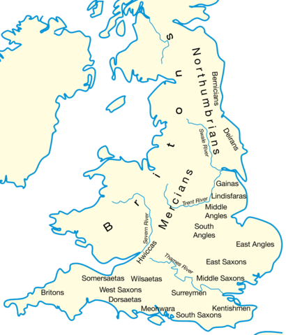
Drawn by User:IMeowbot; border data from CIA, people locations from The Historical Atlas by William R. Shepherd, 1926 edition, with clarifications supplied by en:User:Everyking per references used in en:Penda of Mercia.
Hmm, there's nothing very united about these kingdoms, feel free to reclassify if you've a better idea!
File usage
The following pages on Schools Wikipedia link to this image (list may be incomplete):


